Navigation Systems
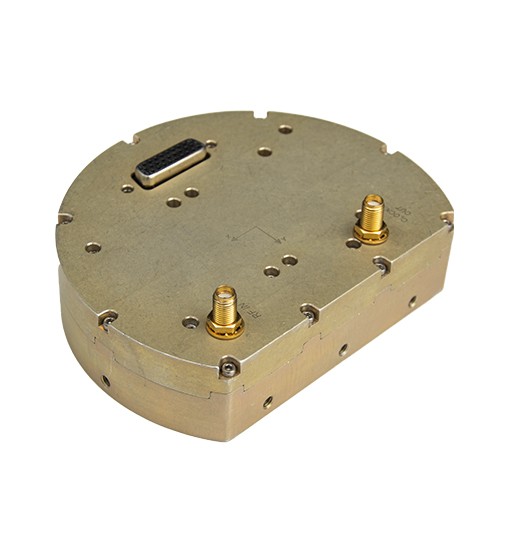
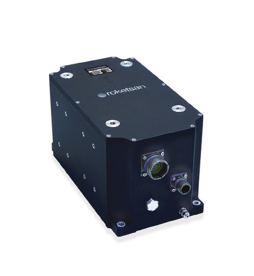
Global Navigation Satellite System Receiver
Global Navigation Satellite System Receiver; design, production and testing infrastructure ROKETSAN’s is a Global Navigation satellite System receiver.
The receiver, which uses GPS, GLONASS and GALILEO satellite systems, is adaptable to different platform [missile, guided ammunition, unmanned aerial vehicle, land vehicle, etc.].
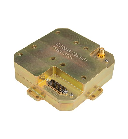
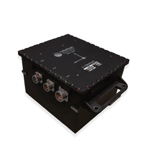
Multi-Constellation and Multi-Frequency Global Navigation Satellite System Receiver
It is a GNSS receiver, whose design, production and test infrastructure is at Roketsan, and which simultaneously uses civil coded signals at multiple frequencies [L1 and L2] from all Global Positioning Systems [GPS, GLONASS, GALILEO, BEIDOU]. Its resistance to jamming and spoofing has been significantly enhanced by both the multi-constellation multi-frequency receiver structure and algorithm/software updates.
Multi-Constellation and Multi-Frequency Global Navigation Satellite System Receiver GNSS receiver can be integrated into missile, land, air and sea platforms.
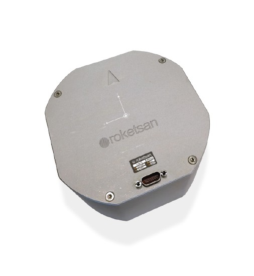
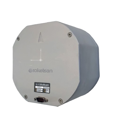
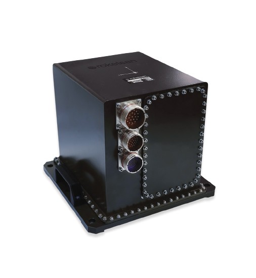
TurNa-TM
Tactical Grade FOG Inertial Measurement Unit
TurNa-TM, is a tactical grade Inertial Measurement Unit [IMU] consisting of three Fiber Optic Gyroscopes [FOG] and three Micro Electro Mechanical Systems [MEMS] accelerometers, which can be used in various practices of guidance, control and navigation.
TurNa-TM, which can sustain high performance under harsh environmental conditions and with high dynamic platforms, can be integrated into missiles, guided munitions, stabilized platforms and flight control systems of unmanned aerial and similar vehicles. systems of unmanned aerial and similar vehicles.
TurNa-TK
Tactical Grade FOG Inertial Measurement Unit
TurNa-TK, containing three Fiber Optic Gyroscopes [FOG] and three Quartz Pendulum Accelerometers, is a tactical grade Inertial Measurement Unit [IMU].
TurNa-TK, which can sustain high performance under harsh environmental conditions and with high dynamic platforms, can be integrated into missiles, guided munitions, stabilized platforms and flight control systems of unmanned aerial and similar vehicles.
TurNa-N
Navigation Grade FOG Inertial Measurement Unit
TurNa-N is a navigation grade Inertial Measurement Unit [IMU] consisting of three Fiber Optic Gyroscopes [FOG] and three Quartz Pendulum Accelerometers. Designed to sustain high performance under harsh environmental conditions, TurNa-N can be used on different platforms such as land vehicles, fire control systems, unmanned aerial vehicles and naval vessels.
With its high performance, TurNa-N can satisfy both Global Navigation Satellite System [GNSS] aided and pure inertial navigation [0.8 nmi/hr] requirements.
RNU-100M
Navigation Grade FOG Inertial Measurement Unit
RNU-100M is a navigation grade Inertial Measurement Unit [IMU] developed for land, aerial and naval platforms.
RNU-100M can satisfy high navigation performance and adverse environmental requirements through its Ring Laser Gyroscope [RLG] and Quartz Pendulum Accelerometer technologies.
RAL2000
Navigation Grade FOG Inertial Measurement Unit
The RAL2000 is a navigation grade Inertial Measurement Unit [IMU] that has been developed for land, sea and air platforms, including unmanned aerial vehicles.
The RAL2000 can satisfy high navigation performance and adverse environmental requirements through its Ring Laser Gyroscope and Quartz Pendulum Accelerometer technologies. It is an upgraded version of RNU-100M in terms of mass and volume.
ALBATROS
Modular Integrated Navigation System
ALBATROS is a modular integrated Inertial Navigation System [INS] that can utilize different Inertial Measurement Units [IMU] and Global Navigation Satellite System [GNSS] receivers. Its modular architecture enables the user’s compatible IMUs and GNSS receivers to transform into an INS that can be used with various platforms. In addition, by means of its integrated structure, TurNa-TQ/TM/N and ANTARES can be used with ALBATROS to obtain an INS that meets the system requirements.
Another feature of the modular architecture is its embodiment of the navigation algorithms required for land, aid and naval applications. This ensures that a particular INS can provide the same level of navigation precision when integrated into different platforms [missiles, guided munitions, unmanned aerial vehicles, land platforms, naval vessels etc.].
RNL2000-K
RLG Based Inertial Land Navigation System
RNL2000-K is an Inertial Navigation System [INS] that has been designed to meet the requirements of land platforms.
RNL2000-K is capable of providing high navigation performance and overcoming adverse environmental requirements through its Ring Laser Gyroscope technologies. Optionally, RNL2000-K can be provided with a Navigation Control and Visualization Unit [NCVU].
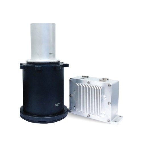
STAR TRACKER
Navigation System
Designed, developed tested and verified in ROKETSAN, Star Tracker provides precise orientation data for platforms that experince high dynamics and fly at high altitudes. Star Tracker is used in support for the inertial navigation system.
The system provides precise orientation data and is aimed to be used in high altitude and highly dynamic applications in support of the inertial navigation system.
Operability Under Highly Dynamic Conditions
Since the Star Tracker is aimed to be used in a highly dynamic system, optical and mechanical designs are done to accomodate high vibration , shock and high temperature conditions. To eliminate the effects of vibration and angular motion on the star trackers’ output accuracy filtering image distortion studies are ongoing.